


Say 8 Voting District, Ashtabula County, Ohio
About
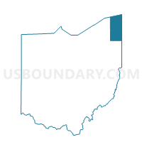
Outline

Summary
| Unique Area Identifier | 642664 |
| Name | Say 8 Voting District |
| County | Ashtabula County |
| State | Ohio |
| Area (square miles) | 7.04 |
| Land Area (square miles) | 7.04 |
| Water Area (square miles) | 0.00 |
| % of Land Area | 100.00 |
| % of Water Area | 0.00 |
| Latitude of the Internal Point | 41.84581250 |
| Longtitude of the Internal Point | -80.88248190 |
Maps


Graphs
Select a template below for downloading or customizing gragh for Say 8 Voting District, Ashtabula County, Ohio


Neighbors
Neighoring Voting District (by Name) Neighboring Voting District on the Map
- Voting District 007999, Ashtabula County, OH
- Gen Twp 3 Voting District, Ashtabula County, OH
- Say 1 Voting District, Ashtabula County, OH
- Say 3 Voting District, Ashtabula County, OH
- Say 5 Voting District, Ashtabula County, OH
- Say 9 Voting District, Ashtabula County, OH
Top 10 Neighboring County Subdivision (by Population) Neighboring County Subdivision on the Map
- Geneva township, Ashtabula County, OH (11,098)
- Saybrook township, Ashtabula County, OH (9,853)
- County subdivisions not defined, Ashtabula County, OH (0)
Top 10 Neighboring Unified School District (by Population) Neighboring Unified School District on the Map
- Ashtabula Area City School District, OH (28,175)
- Geneva Area City School District, OH (16,943)
- School District Not Defined (Water), OH (4)